Reported by:

Cherry Meigh Timbol
News Content Editor
Published November 19, 2026
A magnitude 5.9 earthquake struck off the southern coast of Peru early Wednesday, November 18, prompting seismic monitoring by international and Peruvian authorities. The earthquake occurred offshore near the Ica region, west-northwest of San Juan de Marcona, according to the United States Geological Survey (USGS).
The earthquake was recorded at 6:07:42 UTC (1:07 a.m. local time in Peru), approximately 85 kilometers west-northwest of San Juan de Marcona. The USGS measured its depth at 21.9 kilometers below the Earth’s surface.
Different Agencies Report Slightly Different Measurements
The USGS recorded the earthquake at magnitude 5.9, while Peru’s Geophysical Institute (IGP), in a bulletin reproduced by the National Institute of Civil Defense (INDECI), reported a magnitude of 6.0.
The Peruvian bulletin placed the epicenter approximately 96 kilometers west of San Juan de Marcona, in the province of Nasca, Ica region, and measured its depth at 36 kilometers.
These differences reflect variations in seismic monitoring and calculation methods used by different agencies. Both reports refer to the same earthquake.
No Tsunami Threat Reported
Peru’s National Institute of Civil Defense reported that the earthquake produced an intensity of IV on the Modified Mercalli scale in San Juan de Marcona, indicating moderate shaking.
The country’s Hydrographic and Navigation Directorate (DHN) reported that the earthquake did not generate a tsunami along the Peruvian coastline.
The USGS also issued a green PAGER alert, indicating a low likelihood of earthquake-related casualties and significant economic losses based on its initial assessment.
Another Earthquake Recorded in the Same Area
Seismic monitoring also recorded a separate magnitude 4.0 earthquake at approximately 2:24 a.m. local time on November 18, about 94 kilometers west of San Juan de Marcona.
The additional tremor was included in INDECI’s November 18 seismic monitoring bulletin.
Authorities Continue Monitoring Seismic Activity
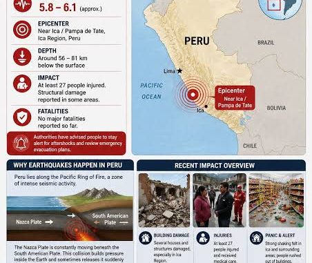
Peru is located along the Pacific Ring of Fire, a region characterized by frequent seismic activity resulting from the interaction of tectonic plates.
The country’s position along the boundary between the Nazca and South American plates makes it particularly susceptible to earthquakes.
Authorities have issued standard earthquake safety reminders, including remaining calm, staying away from windows and objects that could fall, and moving to designated safe areas when necessary.
As of the initial official reports reviewed, there was no confirmed major damage or casualty figure provided in the cited bulletins. The full extent of the earthquake’s effects therefore remains subject to further assessment.