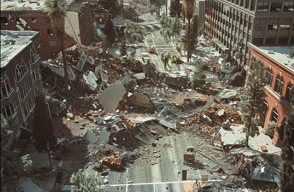
Researchers found that 159.2 million people live in areas exposed to ‘very strong’ shaking under the latest US Geological Survey (USGS) hazard model. Above is an AI-generated stock image
Published August 9, 2026
CALIFORNIA — A renewed warning about California’s earthquake vulnerability is putting the threat of the long-feared “Big One” back in the spotlight, with scientists emphasizing that major portions of the state remain exposed to potentially devastating seismic activity.
Recent reporting has highlighted concerns surrounding California’s major fault systems, while U.S. Geological Survey hazard assessments show that damaging earthquake shaking remains a significant risk across large parts of the United States.
The latest warnings do not mean scientists can predict that a massive earthquake is about to strike. Instead, they underscore a long-established reality: California sits on one of the world’s most active earthquake regions, and a major rupture could produce widespread damage.
The ‘Big One’ Remains a Major California Threat
California’s most notorious seismic threat is the San Andreas Fault, a massive fault system extending through much of the state.
Scientists have modeled scenarios involving a magnitude 7.8 earthquake on the San Andreas, with simulations showing the potential for nearly two minutes of intense shaking across parts of Southern California. Seismologist Lucy Jones has previously emphasized that the San Andreas is capable of producing some of California’s largest earthquakes.
A major rupture could affect heavily populated areas, disrupt transportation and utilities and cause extensive structural damage.
The danger is particularly concerning because millions of people live in areas where strong shaking could occur.

The map shows how estimated earthquake danger has changed across six versions of the National Seismic Hazard Model. Red areas have remained at high risk or become more hazardous, blue areas have remained at low risk or become less hazardous, and gray areas show no clear change
USGS Maps Show Where the Risk Is Highest
The USGS National Seismic Hazard Model identifies areas across the country where damaging earthquake shaking is more likely.
The agency’s hazard maps are designed to show the potential for damaging shaking over long time periods rather than predict a specific earthquake on a particular day.
California remains one of the nation’s most prominent earthquake-risk regions because of its extensive network of active faults.
The USGS maintains earthquake and fault maps that allow residents and officials to examine seismic hazards affecting particular communities.

Danger has increased around the New Madrid Seismic Zone (center, right) in the central US, while heavily traveled bridges make New York, Atlanta and St Louis unexpectedly vulnerable to severe disruption
Los Angeles Faces Significant Long-Term Risk
The danger is particularly significant around the Los Angeles region.
USGS estimates from the Uniform California Earthquake Rupture Forecast indicate a 60% probability of a magnitude 6.7 or greater earthquake occurring in the Los Angeles region over a 30-year period, based on the forecast cited by the agency. The same assessment put the probability of a magnitude 7 earthquake at 46% and magnitude 7.5 at 31%.
Those figures do not predict when such an earthquake will occur.
Instead, they illustrate why emergency planners and scientists continue to emphasize preparation.
Scientists Raise Concerns About Fault Stress
Recent research has added another layer to the discussion.
A study highlighted in July reported that portions of the San Andreas Fault near Southern California may have accumulated significant tectonic strain. The findings renewed concerns about the long-term potential for a major earthquake in the region.
Other recent scientific reporting has similarly warned that seismic pressure beneath portions of Southern California may be unusually high compared with historical measurements.
But scientists caution that high stress does not provide a timetable.
Earthquakes cannot currently be predicted with enough precision to say that a specific fault will rupture on a particular date.
Recent Earthquake Activity Keeps Residents on Alert
California has also experienced continuing seismic activity.
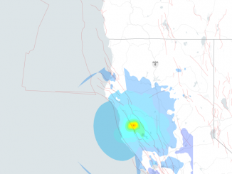
A magnitude 4.0 earthquake struck near Covelo in Northern California on Aug. 4, with shaking reported across several nearby communities. The event caused no reported major casualties or damage and received a low USGS alert classification.
Smaller earthquakes are common in California and do not necessarily signal that a larger earthquake is imminent.
Nevertheless, every significant earthquake serves as a reminder of the state’s underlying seismic vulnerability.
Why the Next Major Earthquake Could Be So Destructive
The danger is not limited to the initial shaking.
A major earthquake could damage roads, bridges, pipelines, electrical networks, telecommunications infrastructure and water systems.
Older buildings may also be particularly vulnerable, especially structures that have not been retrofitted to modern seismic standards.
A major Southern California earthquake could therefore create a cascading emergency in which multiple critical systems fail simultaneously.
Earthquake Early Warning Is Not Earthquake Prediction
California has invested heavily in earthquake early-warning technology.
Systems such as ShakeAlert can detect an earthquake after it begins and potentially provide seconds of warning before stronger shaking reaches some locations.
That distinction is important.
Early-warning systems do not predict earthquakes before they happen. Instead, they rapidly detect an earthquake that has already started and attempt to warn people before the strongest shaking arrives.
Those few seconds can potentially allow people to take protective action, slow trains, stop industrial processes or move away from dangerous equipment.

Southern California’s major fault system is more stressed than at any point in the last 1,000 years, research shows.

A new study suggests the risk of “The Big One” in California could be greater than previously believed.ABC 7
Preparation Could Make the Difference
Scientists and emergency officials have repeatedly stressed that preparation is one of the most effective ways to reduce earthquake losses.
Residents can take basic steps such as securing heavy furniture, preparing emergency supplies, identifying safe locations inside buildings and learning how to respond during an earthquake.
The standard response during strong shaking is commonly summarized as Drop, Cover and Hold On.
The goal is to reduce injuries from falling objects, broken glass and collapsing materials.
⚠️ Implications:
💬 Overall Takeaway:
California’s renewed earthquake warnings should be viewed as a call for preparedness rather than a prediction of an imminent “Big One.” Scientists cannot currently determine exactly when a major earthquake will strike, but long-term hazard assessments make clear that California remains one of the nation’s most earthquake-prone regions.
A major rupture could have far-reaching consequences, potentially affecting millions of residents, homes, transportation networks, utilities, hospitals, businesses and the broader U.S. economy. The potential scale of the damage makes infrastructure upgrades, emergency planning and public preparedness increasingly important.
Ultimately, the greatest lesson is that California cannot prevent a major earthquake, but it can reduce its consequences. Strengthening vulnerable structures, improving early-warning systems and ensuring residents are prepared could make a critical difference when the next major earthquake eventually occurs.
SOURCES: DAILYMAIL ONLINE – Earthquake warning for 159 million Americans as danger zones dramatically expand
THE NEW YORK POST – California’s top earthquake expert issues chilling new warning on ‘The Big One’: ‘It could be tomorrow’